Skytrek

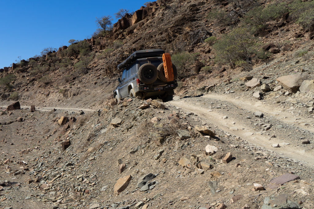
While the track around Skytrek isn’t extremely challenging, there are steep climbs and descents and some tricky bits. You’ll need a vehicle with low range, and some off-roading experience to enjoy the drive.

Skytrek
Skytrek
Skytrek

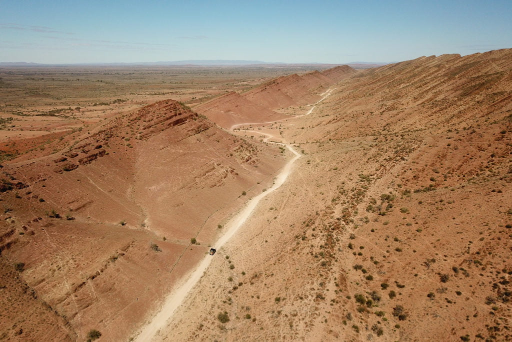
Skytrek loops out into the heart of the property and the vast Flinders Ranges. The ridgelines genuinely are breathtaking, it was hard to concentrate on driving with the constant distraction of the landscape.

Skytrek
Skytrek
Skytrek

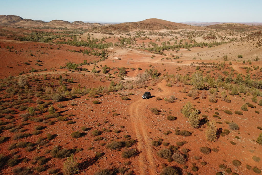
It’s a varied landscape too, with wooded valleys around one bend, followed by slipping scree slopes around the next.

Skytrek
Skytrek

What is Skytrek?

Skytrek is a well-managed, one-way track, with a limited number of vehicles permitted each day. While there were plenty of travellers out on the day we drove it, we only encountered two other groups.

Willow Springs Station issues each vehicle with a map and track notes. The track notes really added value to the trip for us. They highlighted a variety of trees, aboriginal Petro-glyphs, dingo traps, lookouts and Old Moxans’ Hut.

On the top of Vambata Hill, with a second map, we could quickly identify the surrounding peaks, ranges and landmarks.

It’s a big day out, and travellers aren’t permitted to start after 10.30 am. It’s worth starting early, though, and enjoying the drive and the sights along the way.

While the nearby Flinders National Park is spectacular and worth visiting, it’s busier, the tracks are more road-like, and it feels less wild.

Willow Springs Station is a working sheep station and stunning property, and as travellers, we are fortunate to be permitted to explore it. They also offer accommodation and camping.

While the experience is worth it in itself, with the drought, and now fires, visiting rural tourism operations like this is an incredibly powerful way of supporting our farming community.

    Back to blog

    EXPLORE OUR SHOP

    ADVENTURE CURATED APP

    Escaping the responsibilities of everyday life isn’t easy. The Adventure Curated app brings fun to the planning process and is the perfect place to document your dream trips and get organised so they happen!

    Trip Planner is an iOS, macOS, Android and Web app. One subscription works on every device and can be shared by family members, plus your data cloud syncs, ready for you to continue your planning wherever you are.

    Learn More
    • Madigan Line

      Madigan Line

      The Madigan Line ended up on my bucket list after my first Simpson Desert trip with Gen. We had headed down the Hay River Track to Birdsville and then back...

      Madigan Line

      The Madigan Line ended up on my bucket list after my first Simpson Desert trip with Gen. We had headed down the Hay River Track to Birdsville and then back...

    • Anne Beadell Highway

      Anne Beadell Highway

      On a whim, I decided I needed some desert time. I had my eye on the Madigan Line in the Simpson Desert and settled on the Anne Beadell Highway as...

      Anne Beadell Highway

      On a whim, I decided I needed some desert time. I had my eye on the Madigan Line in the Simpson Desert and settled on the Anne Beadell Highway as...

    • MAXTRAX Indeflate

      MAXTRAX Indeflate

      The MAXTRAX Indeflate is a straightforward tool for airing up and down that can be operated standing. We reviewed the Indeflate when it was first released in 2018. Recently Indeflate...

      MAXTRAX Indeflate

      The MAXTRAX Indeflate is a straightforward tool for airing up and down that can be operated standing. We reviewed the Indeflate when it was first released in 2018. Recently Indeflate...

    1 of 3
    • Piccaninny Gorge

      Piccaninny Gorge

      Within the World Heritage-listed Purnululu National Park lies the spectacular Piccaninny Gorge, the largest within the Bungle Bungle Range. It’s a multi-day hike, one of the few places you’re likely...

      Piccaninny Gorge

      Within the World Heritage-listed Purnululu National Park lies the spectacular Piccaninny Gorge, the largest within the Bungle Bungle Range. It’s a multi-day hike, one of the few places you’re likely...

    • Overland Track

      Overland Track

      To describe Cradle Mountain as magical is an understatement, but the mystery of what lies further into this wilderness lured us to tackle the Overland Track. A short year after...

      Overland Track

      To describe Cradle Mountain as magical is an understatement, but the mystery of what lies further into this wilderness lured us to tackle the Overland Track. A short year after...

    • How to Source and Use Topographical Maps

      How to Source and Use a Topographic Map

      I’ve never met a person who doesn’t love looking at a map. Whether it’s a map of your local park, topographic map or a world globe, they give us opportunities...

      How to Source and Use a Topographic Map

      I’ve never met a person who doesn’t love looking at a map. Whether it’s a map of your local park, topographic map or a world globe, they give us opportunities...

    1 of 3